 vesseltracker.com
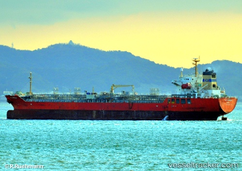
Vessel NO. 2 OCEAN PIONEER IMO: 9340439, MMSI: 538009910 Chemical/Oil Products Tanker
UTC, 21.81271, 66.73482, course: 264, speed: 12
UTC, 21.77776, 66.41863, course: 265, speed: 13.1
2026-02-08 22:23:07 UTC, 22.07412, 66.01065, course: 0, speed: 11.8
Live AIS position:
UTC. 146 nm SW of Keti Bandar),
updated 2026-02-08 22:23:07 UTC.
Find the position of the vessel NO. 2 OCEAN PIONEER on the map. The latter are known coordinates and path.
marine traffic ship tracker show on live map
The current position of vessel NO. 2 OCEAN PIONEER is 22.07412 lat / 66.01065 lng. Updated: 2026-02-08 22:23:07 UTCCurrently sailing under the flag of Marshall Islands
NO. 2 OCEAN PIONEER built in 2006 year
Deadweight:
19991 tDetails:
Last coordinates of the vessel:
UTC, 21.88466, 67.04597, course: 241, speed: 12.1UTC, 21.81271, 66.73482, course: 264, speed: 12
UTC, 21.77776, 66.41863, course: 265, speed: 13.1
2026-02-08 22:23:07 UTC, 22.07412, 66.01065, course: 0, speed: 11.8